
 |
| Loess Hills |
The hills are a collection of silt and dust that took thousands of years to form. They were formed during the ice ages when glacial movement ground up material in the river valley. The light, loose material was blown to the Loess Hills and settled out in the river valley.
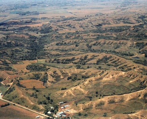 |
| Photo by Gary Hightshoe Drainage developing in thick loess, Monona County |
Loess Hills State Forest, near Iowa's western border in Harrison and Monona counties, comprises 11,484 acres. The main goal of the forest is to implement effective management practices for the benefit of long-term natural resource stewardship. The Loess Hills State Forest Visitors Center near downtown Pisgah is where one can learn about the geology and unique plants and animals of this area. The center is open year-round, with seasonal hours.
The Loess Hills National Scenic Highway features a 220-mile paved main route, with an additional 185 miles of optional excursion loops that range from interstate highways to gravel roads.
 |
| Loess Hills National Scenic Byway |